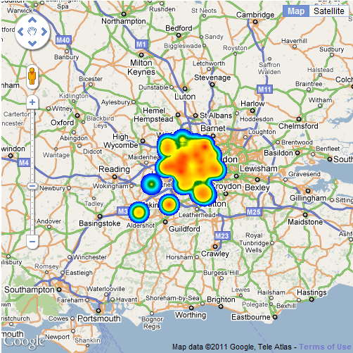
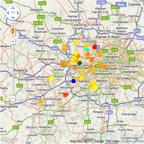
I’ve been looking at the Weather Underground API (http://wiki.wunderground.com/index.php/API_-_XML) which gives access to the observation stations and the data they are collecting.
The API uses simple commands to query for a list of stations, for example:
http://api.wunderground.com/auto/wui/geo/GeoLookupXML/index.xml?query=london,united+kingdom
Using C# and .net, this is accomplished as follows:
[csharp] WebRequest request = WebRequest.Create(string.Format(GeoLookupXML, @"london,united+kingdom"));
HttpWebResponse response = (HttpWebResponse)request.GetResponse();
XmlDocument doc = new XmlDocument();
doc.Load(response.GetResponseStream());[/csharp]
Then the returned XML document is parsed using XQuery to extract the station name, lat/lon coordinates and whether it is an ICAO station or a personal weather station.
[csharp]XmlNodeList Stations = doc.GetElementsByTagName("station");
foreach (XmlNode Station in Stations)
{
XmlNode IdNode = Station.SelectSingleNode("id");
XmlNode ICAONode = Station.SelectSingleNode("icao");
}[/csharp]
This gets us a list of stations ids and ICAOs which can then be used to build individual queries to obtain real time data from every station:
[csharp]foreach (string Id in PWSStations)
{
XmlDocument ob = GetCurrentPWSOb(Id);
XmlNode Ntime = ob.SelectSingleNode(@"current_observation/observation_time_rfc822");
XmlNode Nlat = ob.SelectSingleNode(@"current_observation/location/latitude");
XmlNode Nlon = ob.SelectSingleNode(@"current_observation/location/longitude");
XmlNode NairtempC = ob.SelectSingleNode(@"current_observation/temp_c");
string time = Ntime.FirstChild.Value;
string airtempC = NairtempC.FirstChild.Value;
string lat = Nlat.FirstChild.Value;
string lon = Nlon.FirstChild.Value;
//do something with the data…
}
//NOTE: only slight difference in xml format between PWS and ICAO
foreach (string ICAO in ICAOStations)
{
XmlDocument ob = GetCurrentICAO(ICAO);
XmlNode Ntime = ob.SelectSingleNode(@"current_observation/observation_time_rfc822");
XmlNode Nlat = ob.SelectSingleNode(@"current_observation/observation_location/latitude");
XmlNode Nlon = ob.SelectSingleNode(@"current_observation/observation_location/longitude");
XmlNode NairtempC = ob.SelectSingleNode(@"current_observation/temp_c");
string time = Ntime.FirstChild.Value;
string airtempC = NairtempC.FirstChild.Value;
string lat = Nlat.FirstChild.Value;
string lon = Nlon.FirstChild.Value;
//do something with the data…
}[/csharp]
After that it’s simply a matter of writing all the data to a CSV file so that you can do something with it.